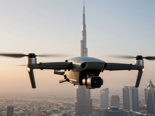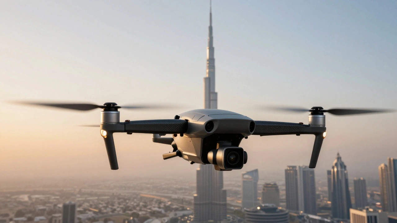
Imagine having a tripod that can suddenly stretch 400 feet into the air. For decades, that kind of perspective was reserved for big-budget movie studios or government agencies who could afford to rent a helicopter. Today, that same power fits in a backpack. Drone Photography is the art of capturing images and video from unmanned aerial vehicles (UAVs) to create perspectives that are physically impossible from the ground. Whether you're a landscape artist or a real estate pro, this tech has completely democratized the sky.
The Tech That Makes the Magic Happen
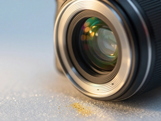
You can't just strap a camera to a remote-controlled plane and expect a masterpiece. Modern aerial shots rely on a few critical pieces of hardware working in perfect harmony. The most important is the Gimbal, a motorized stabilizer that keeps the camera level and steady even when the drone is tilting or fighting the wind. Without it, your footage would look like a shaky home movie from the 90s.
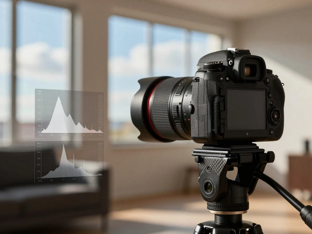
Behind the scenes, the Flight Controller acts as the brain, interpreting your joystick movements and keeping the aircraft from drifting. To stay exactly where you want, drones use a combination of GPS and Inertial Measurement Units (IMU). This allows for "hovering," which is the secret to those perfectly still, high-resolution landscape shots that look like paintings.
Why Drones Beat Traditional Aircraft
If you've ever tried to coordinate a shoot from a manned plane, you know it's a logistical nightmare. Commercial aircraft like the Dash 8 usually have to stay at least 1,000 feet above the ground for safety. Drones, however, can fly just a few feet above a forest canopy or hover inches away from a skyscraper's window. This flexibility creates a level of intimacy with the subject that a helicopter simply can't achieve.
| Feature | Drones (UAVs) | Helicopters/Planes | Balloons/Towers |
|---|---|---|---|
| Cost | Low to Moderate | Very High | Moderate |
| Maneuverability | Extreme (Hover/Swoop) | Moderate | Low (Wind-dependent) |
| Minimum Altitude | A few inches | Typically 1,000+ ft | Fixed by cable/altitude |
| Deployment Speed | Minutes | Hours/Days | Slow |
Compositional Tricks for the Third Dimension
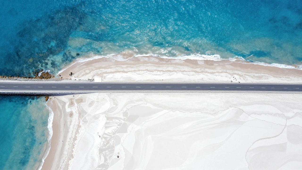
When you move from ground photography to the air, the rules of composition change. Most landscape photographers spend their lives within 10 feet of the dirt. Suddenly, you have a Z-axis to play with. One of the most powerful tools is the "Top-Down" or "God's Eye" shot. By pointing the camera 90 degrees straight down, you turn the world into an abstract painting, emphasizing patterns in the sand, the geometry of a city, or the texture of a crop field.
Then there's Subject Tracking. Modern drones can lock onto a moving car or a running athlete, allowing the pilot to focus on the flight path while the software keeps the subject perfectly centered. If you want something more precise, Waypoint Navigation lets you program a specific flight path. This is how professionals capture the same scene at different times of day with pinpoint accuracy.
Beyond the Art: Industrial Applications
It's not all about pretty sunsets. Drone tech has bled into serious science and business. In the world of Photogrammetry, the process of using multiple overlapping photos to create a 3D model of a physical object or area, drones are replacing expensive land surveys. By using Structure-from-Motion (SfM) techniques, an operator can map an entire archaeological site or a construction zone in a fraction of the time it takes a human with a tripod.
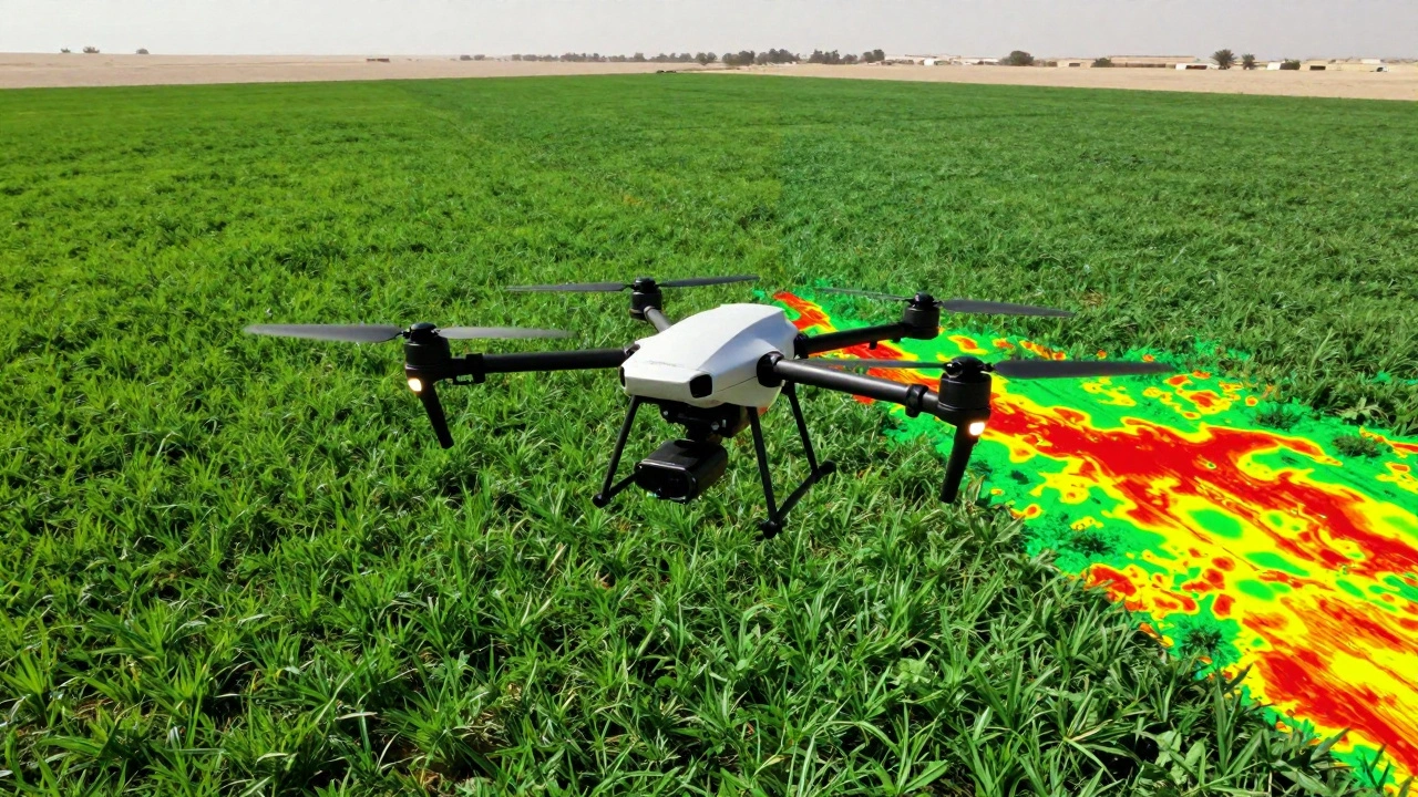
Agriculture has seen a massive shift too. Farmers now use drones equipped with multispectral sensors to calculate the NDVI (Normalized Difference Vegetation Index). Instead of walking miles of rows, they can fly over their crops and see exactly where the plants are stressed or dehydrated based on how they reflect light. It's the difference between guessing where a problem is and having a heat map of your entire farm.
Practical Tips for Your First Flight
If you're just getting started, the biggest mistake is underestimating power needs. Battery life is the "bottleneck" of every drone mission. Always carry at least three spare batteries; you'll find that once you get the perfect angle, you've usually already used 60% of your flight time. Also, keep a close eye on the weather. Even a slight breeze at 300 feet can be twice as strong as it is on the ground, which can drain your batteries faster as the drone fights to stay stable.
Don't forget the legal side. Regulations vary by region, but generally, you need to stay below 400 feet and keep your aircraft within your visual line of sight. Flying into restricted airspace without a permit is a quick way to turn a hobby into a very expensive legal headache.
Do I need a license to take drone photos?
It depends on your intent. If you're flying for fun (recreational), you usually just need to register your drone and follow basic safety rules. However, if you are making money from your photos-such as for real estate or commercial clients-you typically need a commercial remote pilot certification (like the Part 107 in the US) to operate legally.
What is the best height for aerial landscape shots?
There is no single "best" height, but different altitudes serve different purposes. Low-altitude flights (20-100 ft) are great for creating a sense of scale and movement. Mid-range (100-300 ft) is perfect for capturing the relationship between subjects. High-altitude (300-400 ft) is where you get those stunning, abstract patterns and wide vistas.
How does a gimbal actually work?
A gimbal uses brushless motors and sensors (like gyroscopes) to detect the drone's movement in real-time. When the drone tilts forward to move, the gimbal tilts the camera backward by the exact same degree, effectively canceling out the motion and keeping the horizon perfectly level.
Can drones be used for 3D mapping?
Yes, through a process called photogrammetry. By taking many overlapping photos of a site from different angles, software can triangulate the positions of points in space to create a highly accurate 3D model. This is widely used in archaeology, construction, and environmental monitoring.
What is NDVI and why does it matter in drone photography?
NDVI stands for Normalized Difference Vegetation Index. It's a measurement of how plants reflect near-infrared light. Healthy plants reflect more of this light, while stressed plants reflect less. Specialized drone cameras can capture this data, allowing farmers to spot crop disease or drought long before it's visible to the human eye.